Are You Looking for the Remaining Oil and Gas in the Lower 48?
You may have a prospect in a mature trend with developed fields, great well control, and maybe an old 2-D line.
You know more reserves are there, but their exact location and the geology controlling them are not always clear, and bit placement can mean the difference between a dry hole, a marginal producer, or a well that reaches the optimum take point and saves you from drilling another.
La Mesa Geophysical designs ‘prospect-focused’ seismic surveys for Independents who want their exploration dollars spent reducing risk and maximizing reserves in today’s challenging oil and gas industry.
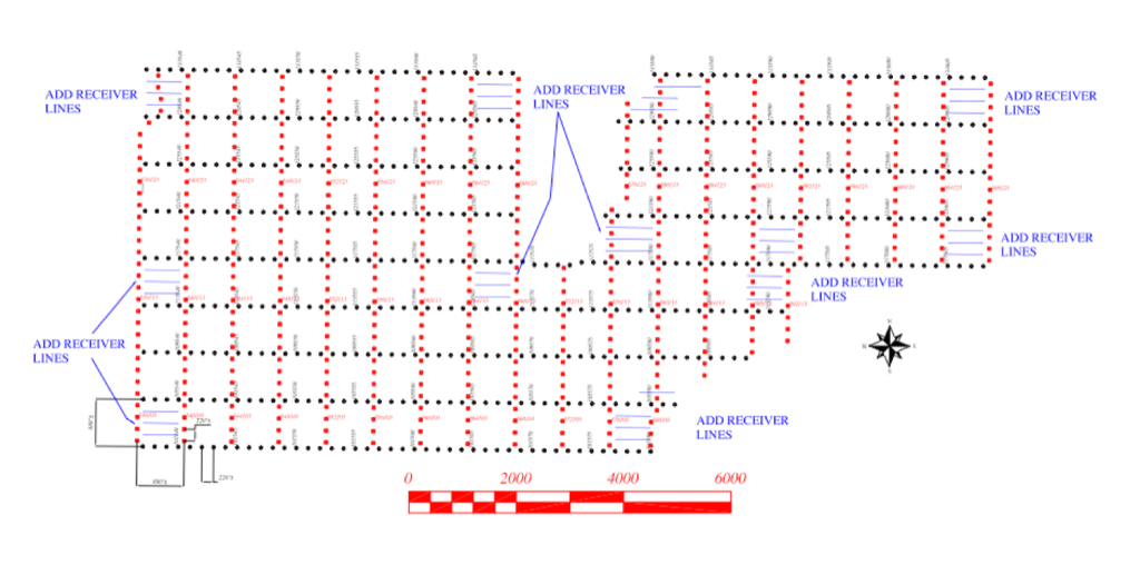
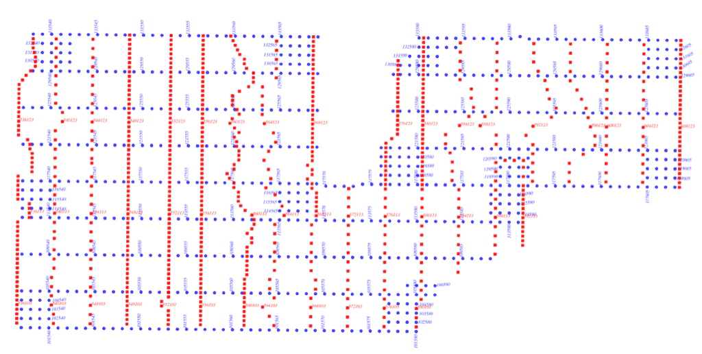
Our no-tails approach concentrates source and receiver effort within the prospect boundary, gathering the subsurface data needed while limiting the offset tails that add leasing, permitting, clearing, surface-damage payments, and acquisition expense.
Reducing Risk on Remaining Reserves
Many Independent oil and gas prospect developers in the US are pursuing residual subsurface targets for exploitation that can yield significant reserves per today’s AFE costs.
These targets are typically in established trends where well control, production histories, and legacy seismic provide a substantial base of information for identifying what remains and deciding where to drill next.
Some of these targets were missed, or weren’t material enough for larger companies to pursue. Either way, billions of BOE are estimated to remain in the Lower 48.
With all this lead-generating data, the challenge remains: how to de-risk smaller subsurface targets while containing development costs?
Seismic survey is a mature technology with proven tools for acquisition planning, field instruments, energy sources, and processing and interpretation software.
La Mesa Geophysical, with over two decades of innovation in prospect-focused surveys, is a resource for Independents to limit prospect development capex while reducing drilling risk with superior seismic data.
We increase source and receiver density within boundaries for no-tails acquisition and have refined a strategy that decreases costs and delivers superior data whether it’s 1, 10 or 20 square miles, and including irregularly shaped prospects. (See below.)
Our geophysical expertise assists Independents in analyzing their geological targets and developing acquisition plans that maximize data yield, and deliver the information you need to resolve take points, reduce risk, and build confidence levels.
Scroll down for more information, or email ken@lamesageophysical.com to learn how La Mesa can be your geophysical partner in development.
Building Your Seismic Survey Plan
La Mesa Geophysical is a technical and operational resource for creating a seismic data acquisition project for your prospect.
Your target, with the existing data and knowledge base, may need only a well-placed 2-D line to tie all of it together and make a location. Or perhaps a multi-line 2-D Swath that generates multiple subsurface lines to further resolve the target with more data over a wider area.
Given our cost-effective acquisition methods, a prospect-focused 3-D can be a better capex choice than 2-D or 2-D Swath, yielding greater data coverage and better statistical evaluation of the subsurface.
Our no-tails 3-D acquisition strategy means higher effort within the boundaries of your leasehold, adding sources and receivers to generate a data set with higher-than-average fold and the geometry needed to resolve your targets.
No tails means less area to lease, permit, clear, and acquire data, which means less work, landman time, and project expense.

Field Operations: Clearing
Most Independents have limited experience with seismic data acquisition. La Mesa will work with you to get the project planned, acquired, processed, and if desired, interpreted.
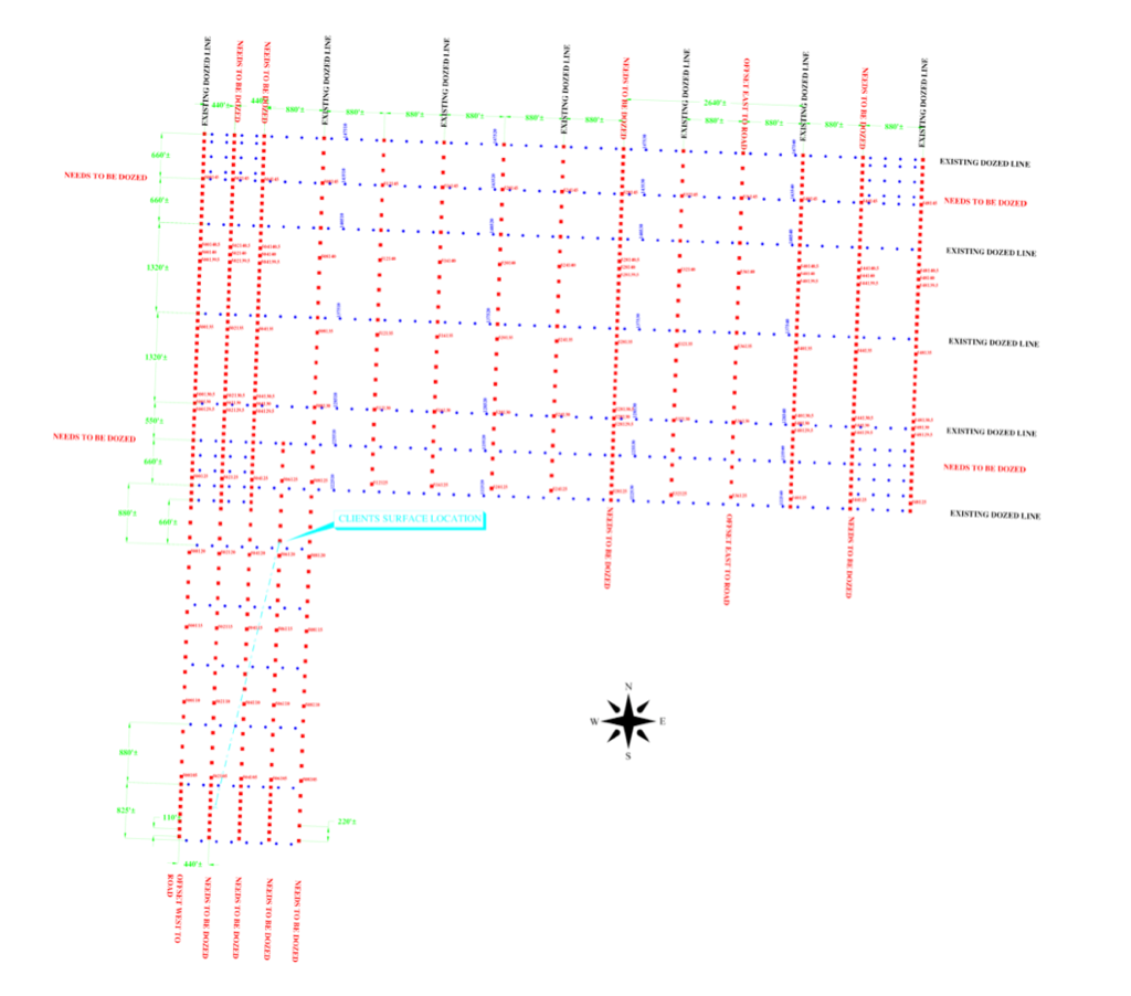
We work with your landman to understand the permit restrictions, especially for surface owners without mineral ownership. This includes avoiding culture, using existing field access points, clearing lines only where needed, and avoiding large tree removal wherever possible to help mitigate surface-damage payments.
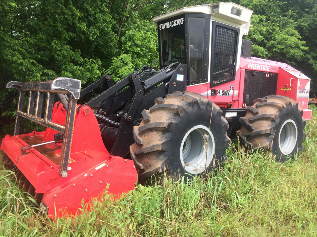
For clearing, we can work with your dozer operator, or secure a bid for mulching using equipment like the machine shown below.
Data Acquisition
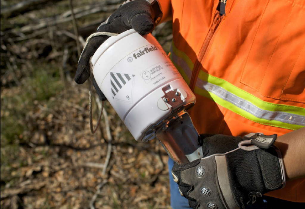
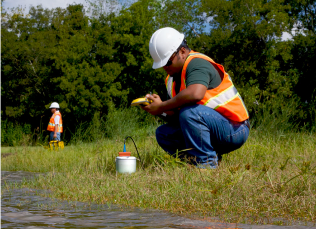
In the field, La Mesa’s light operational footprint reduces surface impact with a wireless Fairfield GEN2 Nodal system that eliminates cables and requires fewer personnel in the field.
Once the crew is mobilized into the field, we work with the landman and surface owners to keep operations smooth with a minimum of surface issues. This includes respecting the land, locking the gates, and avoiding ‘no-go’ areas on the permits.
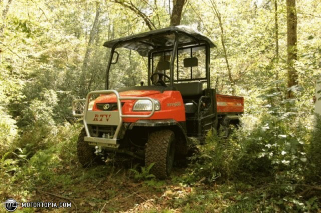
The SeisTrak energy source is an accelerated weight drop mounted in a tracked vehicle that puts less pressure on the ground than a pickup truck.
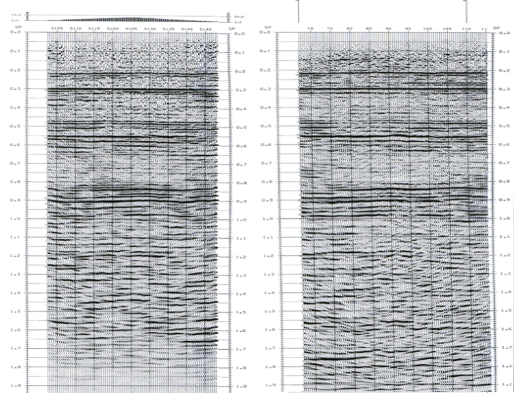
The comparison below shows a line acquired with the XLR8 accelerated weight-drop source on the left and a line acquired using a 60-foot shothole loaded with ten pounds of dynamite on the right.
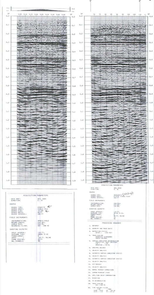
The data is highly comparable in usable frequencies and overall imaging quality. And the source allows us to increase energy as needed, move source points to accommodate the surface, and repeat shots when needed due to environmental conditions.
As to penetration depth, the following images are from La Salle County and central New Mexico and show basements of ~17,000 vertical feet.
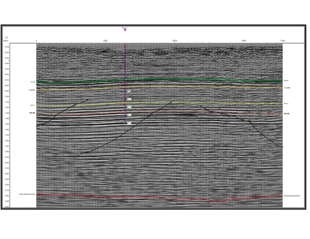
Seismic energy penetration, usable frequency, and total data yields vary based on geological composition, depositional complexity, faulting, etc.
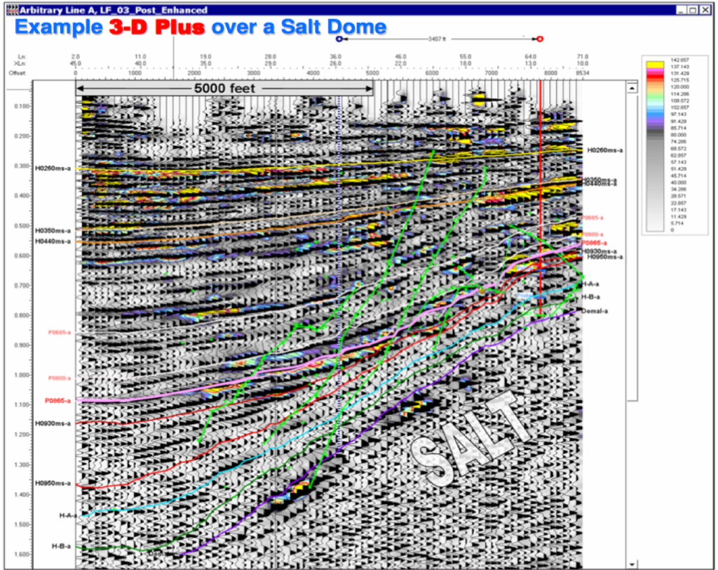
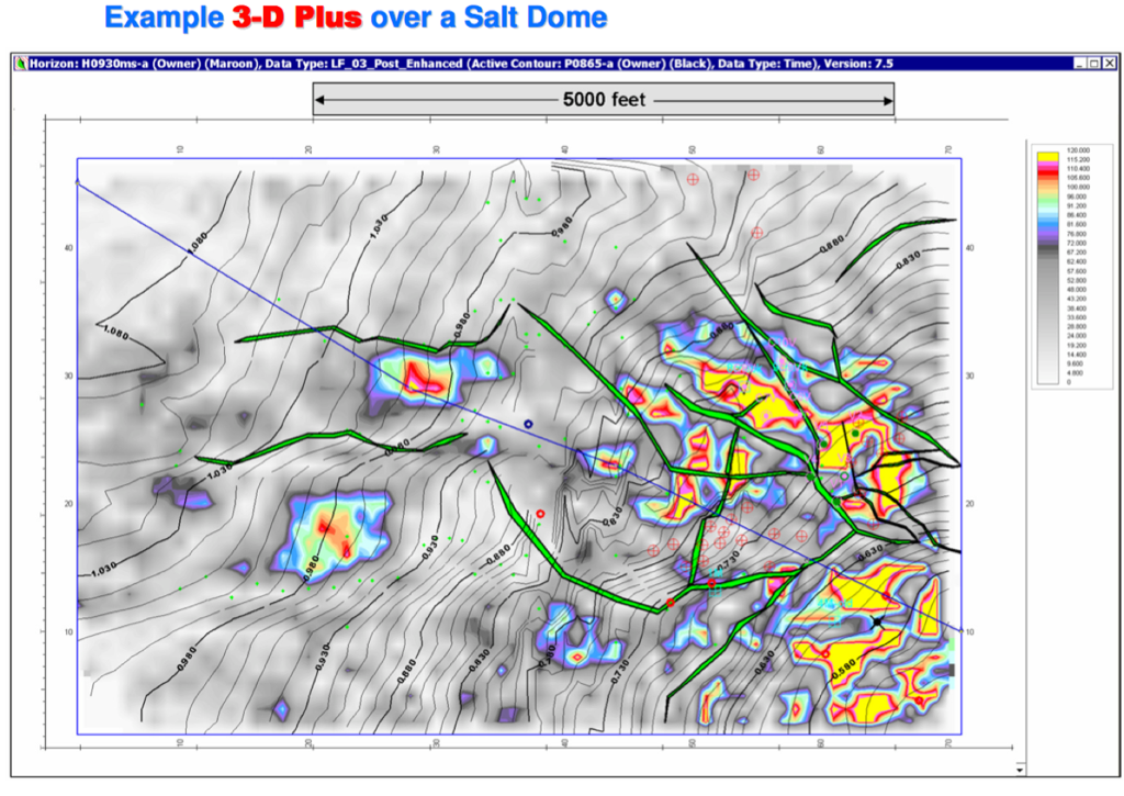
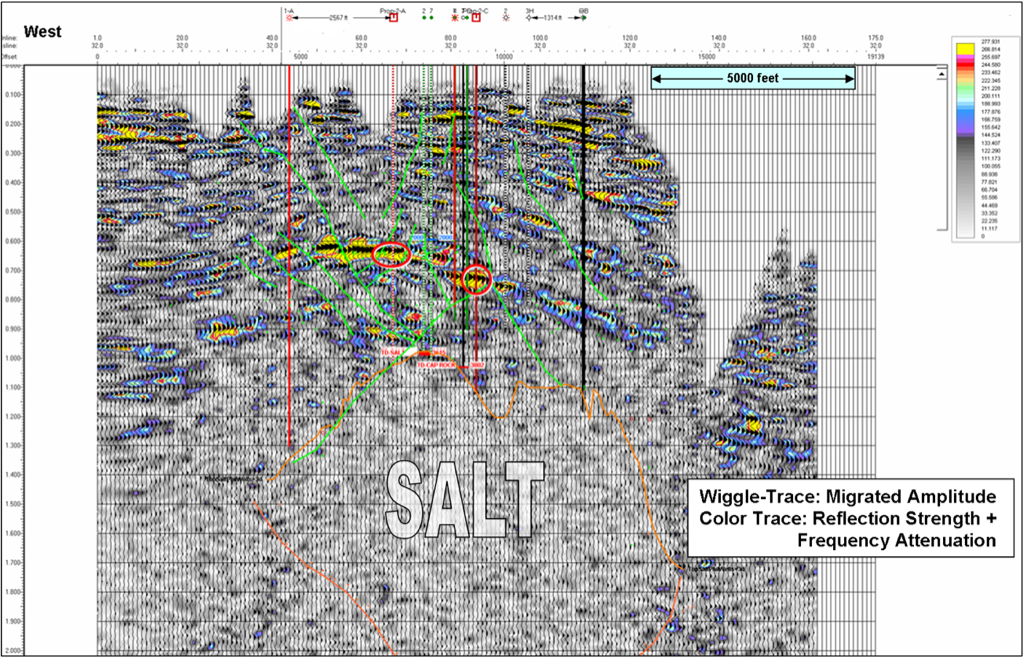
We have further refined our prospect-focused 3-D strategies on salt dome acquisitions that have had both surface and subsurface acquisition challenges. Salt domes are some of the more difficult seismic targets given the geological complexity, steep dips, and existing surface operations. The data below also shows both the data and the interpretation capabilities of today’s software.
Data Processing & Interpretation
La Mesa Geophysical works with your chosen data processor and provides the required SEG data formats, observer notes, and GPS receiver and source point information needed to create an accurate data volume for processing.
Tell Us About Your Prospect
Whether you have a prospect ready to evaluate or a question about how seismic might help, email Ken and tell us what you have in mind. Your inquiry will receive our attention, and we will respond personally.